
Mach9 Digital Surveyor Customers Unlock New Productivity Gains with SeamlessLeica LGSx Integration
Mach9 customers can now deliver data from any Leica Geosystems reality capture hardware into Digital Surveyor, eliminating custom exports and transforming weeks of manual work into hours of automated feature extraction.

San Francisco, USA, May 14, 2026 — Mach9, a San Francisco-based geospatial software company specializing in automated 3D mapping from point cloud and LiDAR data, today announced a strategic technical integration with Leica Geosystems, part of Hexagon. The collaboration helps remove a key bottleneck between reality capture and the delivery of engineering-ready outputs.
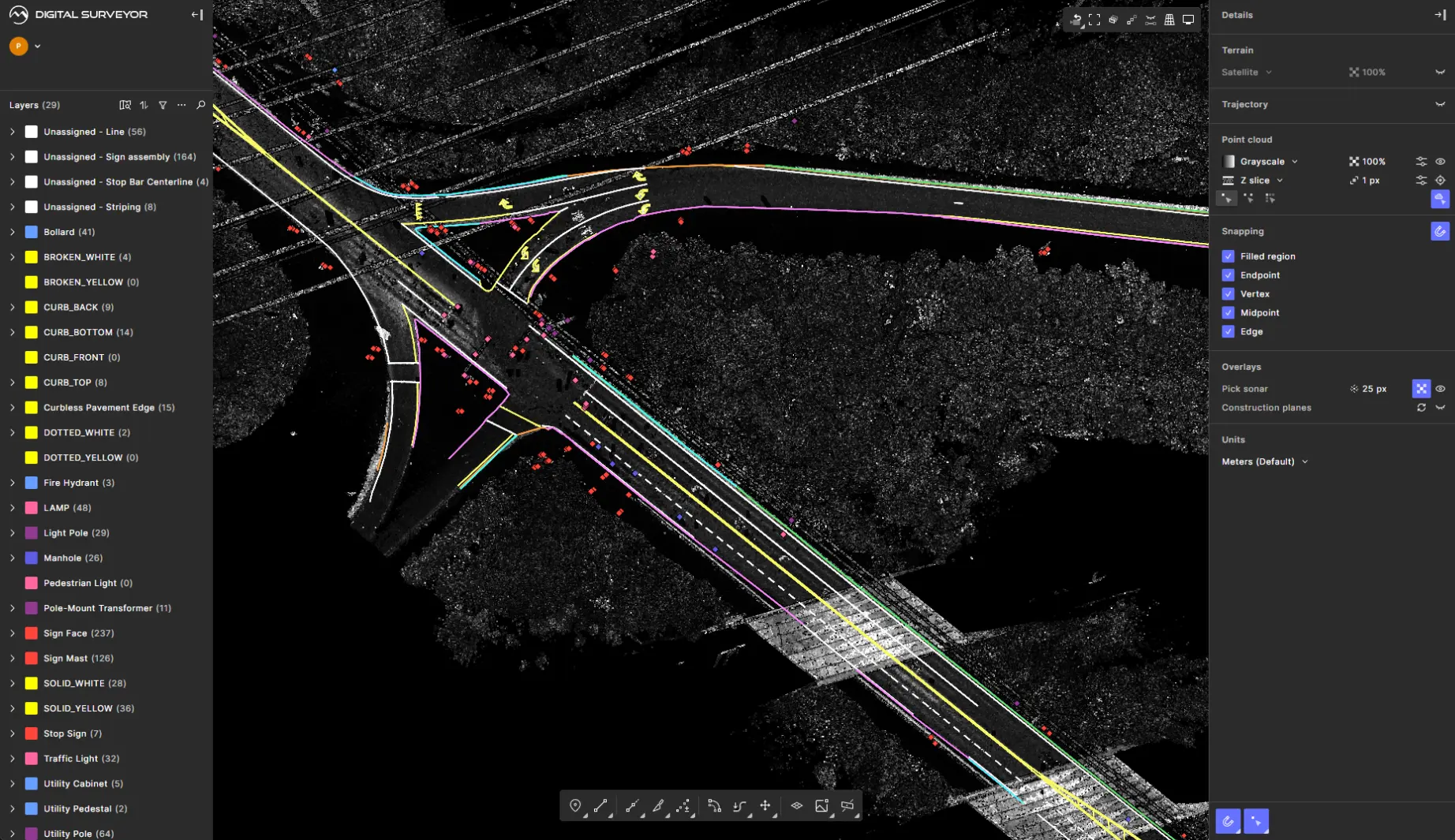
The integration of Leica Geosystems' LGSx data format into Mach9's Digital Surveyor 2 platform creates a field-to-finish workflow, enabling data to flow seamlessly from Leica Geosystems' industry-leading hardware, including the Leica Pegasus TRK mobile scanners, Leica RTC360, Leica BLK360, and Leica BLK2GO, into Mach9's AI-powered feature extraction software without manual data exports. This integration allows Digital Surveyor 2 to directly access:
- High-density point clouds with RGB color information
- Panoramic imagery from 360° cameras
- Planar imagery from “butterfly” cameras
- Project metadata including units and georeferencing information
By combining Leica Geosystems' reality capture platform with Mach9's cutting-edge artificial intelligence, the partnership delivers processing speeds up to 100x faster than traditional workflows while maintaining engineering-grade accuracy. This unlocks significant productivity gains for customers, offering an efficient approach to creating survey and engineering deliverables from 3D data.
“Our customers need their reality capture data to move easily across the tools they rely on,” said Raphaël Goudard, Director of Sales and Business Development at Hexagon's Scanning & Mapping Division. “Expanding native support for LGSx in third-party platforms is an important step in making that possible — reducing the need for conversion, preserving data fidelity, and helping teams work more efficiently across their workflows.”
An Easier Workflow
Traditional post-processing workflows required exporting to LAS files and images with manual configuration and steps, introducing potential errors and consuming valuable time. Digital Surveyor now natively reads Leica LGSx files, automatically loading point clouds, imagery, and geospatial metadata directly from Leica's office processing software.
Engineering firms Olsson and Langan, both customers of Mach9, have already applied the integrated workflow across active infrastructure projects, realizing significant gains in productivity and turnaround time.
“With the new Leica Geosystems and Mach9 integration, we are able to just drag our files straight out of our mobile scanner and bring it right into Mach9,” said Eddie Fossler, Vice President at Olsson. “That in and of itself has eliminated a huge perception of friction. Having that integrated and simplified changes the whole conversation for us. We have always gone after big projects. They can be very challenging. We have a mall that's being redone and renovated. It's got a massive parking lot element. With these tools, I can see that we'll have that whole parking lot squared away in like 10 minutes. The software is filling that gap for teams dealing with massive datasets.”
“Data integrity is paramount when you're delivering engineering-grade deliverables for critical infrastructure projects,” said Alexander Baikovitz, CEO and Co-founder of Mach9. “By natively supporting the LGSx format, Digital Surveyor 2 preserves 100% of the rich data captured by Leica Geosystems' hardware — from precise point cloud coordinates to panoramic imagery and project metadata. Our customers can trust that the intelligence they capture in the field translates directly into accurate, actionable deliverables.”
Accelerate Time-to-Deliverable
Manual feature extraction from complex mobile LiDAR datasets could take days or weeks per mile of corridor, creating project delays. Mach9's AI analyzes LGSx point clouds in real-time, suggesting geometry and automatically extracting features like pavement markings, utility poles, and curbs, reducing processing from days to minutes.
“It's much faster to review something than to create something. We're getting 3,000 feet of curb — with curb cuts, ramps, everything — that doesn't have to be touched. The extractor's role becomes QA/QC and I predict it will also reduce labor costs by another 10 to 20 percent at least,” said Russell Hall, Senior Survey Project Manager at Langan.
Experience the Integration
To find out more information about how to transform your reality capture workflow and unlock the full potential of your Leica hardware investment via the native LGSx support in Digital Surveyor 2, visit Mach9's Leica webpage and sign up for a demo: mach9.ai/partners/leica.
About Mach9
Mach9 accelerates how teams model and understand the world with automated feature extraction technology. Founded in 2021 and headquartered in San Francisco, Mach9's flagship Digital Surveyor platform helps transportation agencies and engineering firms extract miles of road corridor projects in a fraction of traditional processing time. Built on decades of research from Carnegie Mellon University's Robotics Institute, Mach9 empowers the architecture, engineering, and construction industries to tackle large-scale infrastructure projects with unprecedented speed and accuracy. Leading organizations including Langan, Olsson, Woolpert, HDR, and major state DOTs trust Digital Surveyor to create engineering-grade maps for transportation, telecom, and infrastructure delivery.
Learn more at www.mach9.ai.
Contact
Mach9 Robotics Inc.
info@mach9.ai
About Leica Geosystems
With more than 200 years of history, Leica Geosystems, part of Hexagon, is the trusted supplier of premium sensors, software, and services. Delivering value every day to professionals in surveying, construction, infrastructure, mining, mapping, and other geospatial content–dependent industries, Leica Geosystems leads the industry with innovative solutions to empower our autonomous future. Learn more at leica-geosystems.com.
Hexagon (Nasdaq Stockholm: HEXA B) has approximately 24,800 employees in 50 countries and net sales of approximately 5.4bn EUR. Learn more at hexagon.com.