
NOVEMBER 4, 2026
Mach9 now works in the sky
Turn data from drones, helicopters, and planes into finished survey deliverables faster with Mach9’s AI CAD software.

Today, Mach9 expands beyond mobile and terrestrial scanning to support aerial LiDAR and photogrammetry-derived datasets. Survey and geospatial teams can now use Mach9 to turn aerial data into a first draft in hours, then review and refine it into finished drawings and surfaces.
Dozens of civil engineering firms, including Langan, McElhanney, and Welch Comer have already expanded their use of Mach9 from mobile and terrestrial data to include aerial, allowing them to cut delivery times and take on more work.
For Langan, that means taking on multi-thousand-acre projects they otherwise would have turned down. “We've actually had several multi-thousand acre projects in Texas and we would not have been able to complete them in time,” said Russ Hall, Senior Survey Project Manager at Langan. “[Mach9] cut down our time to deliver by weeks. Like, 40%.”
For smaller teams like Welch Comer, those time savings create room for more work. “Anytime we can save time, that allows time for another project. I've seen an average savings of four or five hours per project. [Every] two projects, we're saving a day,” said Thomas Tucker, Survey Project Manager at Welch Comer.
Aerial data collection is fast. Turning it into deliverables still takes too long.
Drones, helicopters, and planes let survey teams capture millions of points across entire sites and corridors, supporting projects from data centers and solar farms to highways and electric transmission lines. As sensors become more capable and affordable, teams can collect more detailed data across larger areas.
Capturing the full site also lets teams respond to requests for additional features without returning to the field. “Not having to return to site is huge. If a client says, ‘You missed this feature,’ it’s now just a few clicks to get that, as opposed to remobilizing a crew, especially if it’s in a remote area,” said Chris Gilling, Division Manager, Laser Scanning at McElhanney.
But turning that data into engineering deliverables still requires hours of manually classifying points, tracing features, and building surfaces. For detailed electric utility engineering projects, a single day of flying can lead to months of office work before engineers can use the results.
That manual work limits how much survey teams can take on and how quickly they can deliver the information needed for design, construction, and maintenance decisions. Faster data collection only gets teams so far if producing the deliverables remains slow.
From aerial data to finished deliverables in one platform.
Mach9 brings AI extraction, CAD editing, classification, and surface modeling into a single web-based CAD application. Survey and geospatial teams upload point clouds from LiDAR or photogrammetry, along with orthomosaic imagery, and Mach9’s AI produces a first draft in hours. Survey teams can then review and refine the linework, adjust point classifications, and build and check surfaces before exporting into downstream CAD and GIS software.
“Now it's basically all I use. I was previously using three to four different software. Mach9 matches all of their strengths, or surpasses most of them, to keep it all on one platform,” said Tucker.
Mach9 now supports the following capabilities:
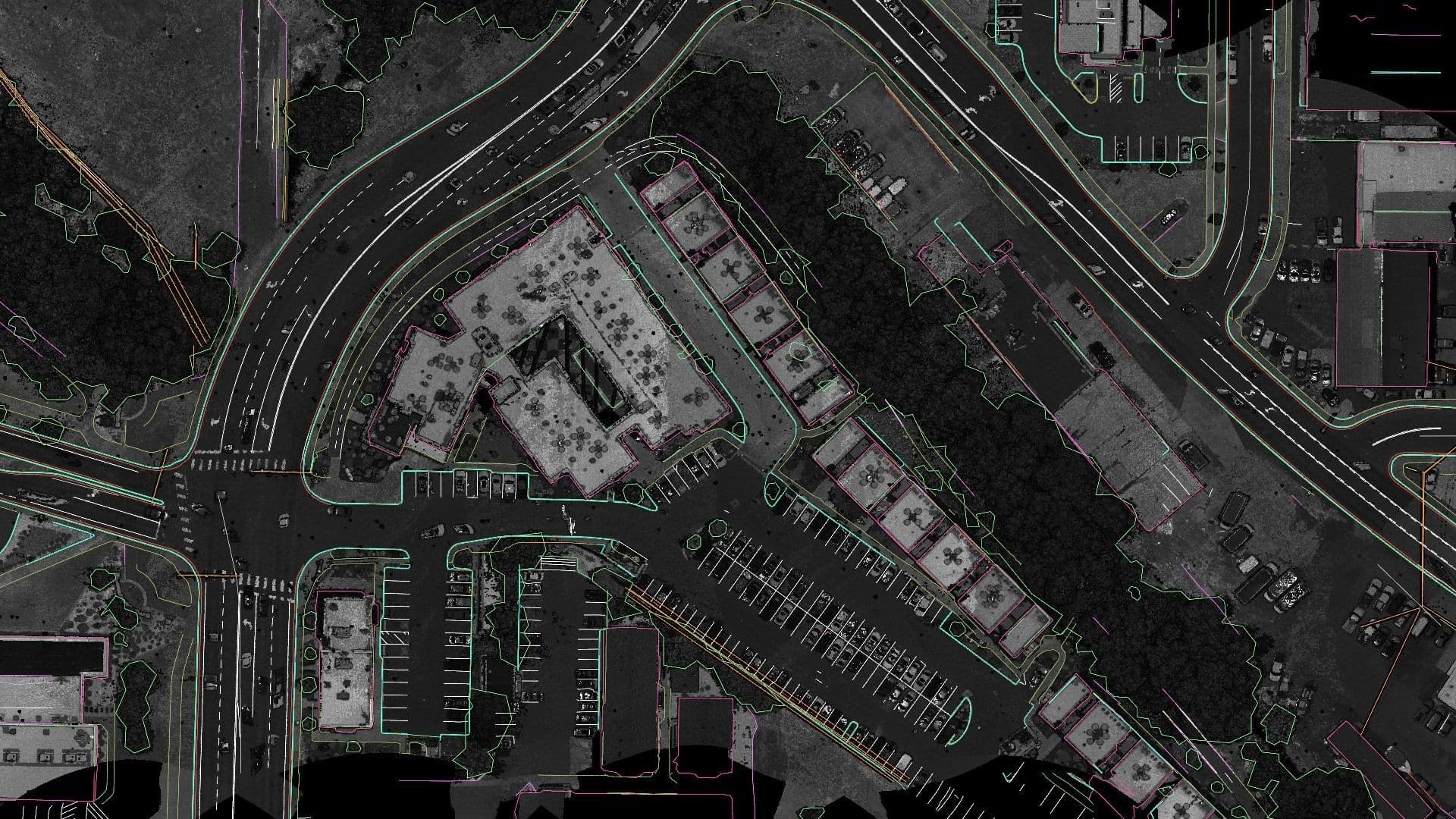
Automatically draft 3D points and lines from aerial data
Automatically extract curbs, building footprints, pavement edges, vegetation outlines, and other planimetric features as 3D points and lines, with centimeter-level accuracy at infrastructure scale.
The extracted linework supports basemapping, site and ALTA surveys, land development, transportation and utility corridor planning, stormwater mapping, airport planning, municipal GIS updates, and urban planning.
Classify and edit point clouds
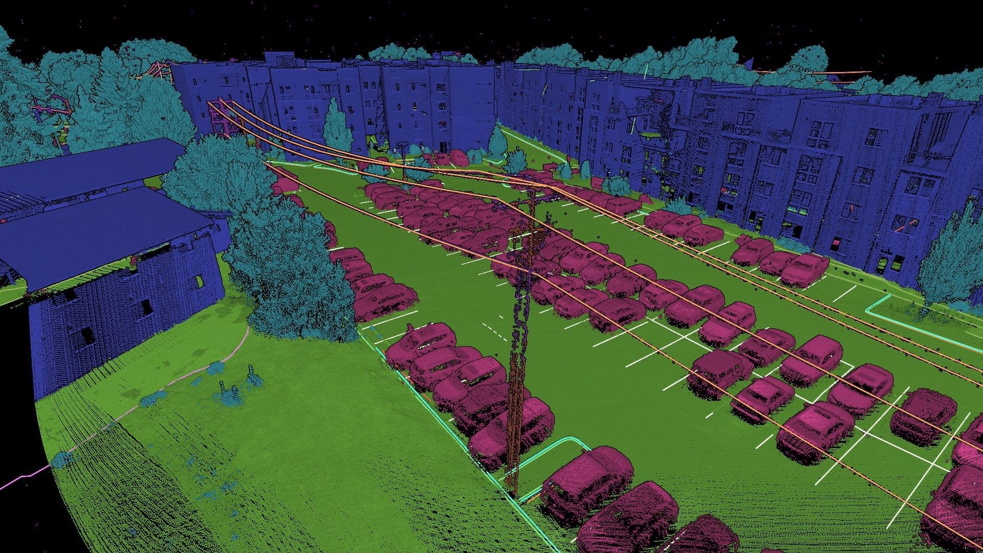
Historically, classifying point clouds has required significant desktop computing resources and hours of manual work. Automated classification can accelerate the process, but the results still need review and refinement to meet the exacting requirements of utility and wide-area projects.
Mach9 combines AI classification with manual editing tools in a single web-based application. Your team can review and refine classifications, deliver complete classified point clouds, and generate more accurate ground surfaces for downstream CAD and GIS workflows.
Model utility poles and wires
Beyond classifying points, Mach9 also supports automated extraction of 3D catenary features and utility poles for electric transmission, distribution, and telecommunications design projects. Based on these features, utility survey and engineering teams can automate clearance analysis, make-ready workflows, and delivery into design and pole loading analysis software.
“You have to sit there with the instrument and measure points on each wire. Now we just fly it with the drone, throw it into Mach9, and get our lines for all these power lines. That's orders of magnitude more efficient than traditional methods,” said Gilling.
Build ground surfaces and contours
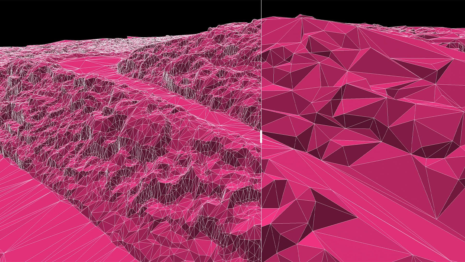
Create detailed 3D ground surfaces, breaklines, and contours for utility engineering and land development projects, from solar and wind facilities to data center sites. Modify vertices and regenerate surfaces rapidly, using a deviation heatmap to visualize high and low points and identify areas that need refinement.
“Before we would have to run basically two different software packages... Now with [Mach9], we're able to build the surface natively inside, check the surface against the point cloud and the extraction, and then export out a LandXML that draws correctly in Civil 3D or OpenRoads,” said Hall.
Compatible with existing aerial mapping hardware and software
Mach9 supports data collected with aerial imaging and LiDAR systems from RIEGL, Leica, Trimble, Skydio, LiDARUSA, GeoCue, Emesent, Phoenix LIDAR, Inertial Labs, YellowScan, Wingtra, Teledyne Geospatial, DJI, and other common drone equipment providers. Points, lines, and surfaces can be exported in industry-standard data formats, such as DXF, DWG, SHP, GDB, and LandXML, for use in downstream civil design and GIS software.
About Mach9
Mach9 is the AI CAD platform for civil engineering, built to expand the world’s capacity to build and maintain critical infrastructure. Its software turns 3D scans into engineering-ready CAD drawings, helping teams work up to 10x faster and at one-fifth the cost. Mach9 has been used across more than 2,500 projects in all 50 states, surveying over 100,000 miles of infrastructure. Founded by engineers from Carnegie Mellon’s Robotics Institute who built systems for the physical world at Tesla, SpaceX, Apple, NASA and Google X, Mach9 is headquartered in San Francisco. Learn more at mach9.ai.