Olsson executes roadway corridor and pad site surveys 60% faster with Mach9.
A demanding DOT highway corridor moved from days of manual extraction to a reviewer-ready first-pass draft in 15 minutes.

We're lucky to have discovered Mach9 when we did. Their feature extraction software is a clear winner if you want to handle the full range of infrastructure work your clients bring you.

Manual Feature Extraction Limited Capacity for Large-Scale Infrastructure Projects
Project demand and data collection requirements were growing faster than the old-fashioned drafting methods could handle. It was tying up our technicians for months at a time, and the work we couldn't take on internally was going to third parties. We needed a more efficient approach to keep pace, and that's what we found in Mach9.
From rural highway corridors to malls and data centers, Olsson produces its own CAD deliverables for every project. However, as demand for large-scale infrastructure projects grew, Eddie Fossler, Vice President and Quality Management Leader, realized that his team's existing drafting processes were limiting their capacity to take on more work.
To produce a complete deliverable, Eddie's technicians had to extract lines and objects in a dense point cloud captured from every project site. While they relied on software to extract overhead power lines for human review, all other features required careful interpretation and manual drafting in CAD, often navigating cluttered curb environments, heavy vegetation, and shadows. "A single 50-mile project would easily occupy us for a month and a half," shares Eddie.
That estimate didn't even include the rigorous QA that deliverables still required for design. Once reviews were completed, technicians flagged features where scans fell short and coordinated crews to collect more site data. All of that added up to weeks of additional work in the field, where fast-moving traffic and uneven terrain increased the chance of injuries.
While each step of this workflow was necessary to ensure accuracy, it also capped Olsson's bandwidth, especially for complex projects from municipal and state agencies. Departments of Transportation (DOTs) and city governments operate long-term programs that require hundreds of miles of survey work, generating stable, ongoing returns. With little to no internal bandwidth, Eddie often found himself routing this work to third parties, leaving growth on the table.
To bridge the gap between capacity and demand, Eddie began evaluating solutions that could automate feature extraction across Olsson's full range of infrastructure projects. That search soon led him to Mach9. After learning about Mach9's system-agnostic feature extraction solution, Eddie realized it was exactly what Olsson needed to take on the full scope of projects that demanded their expertise.
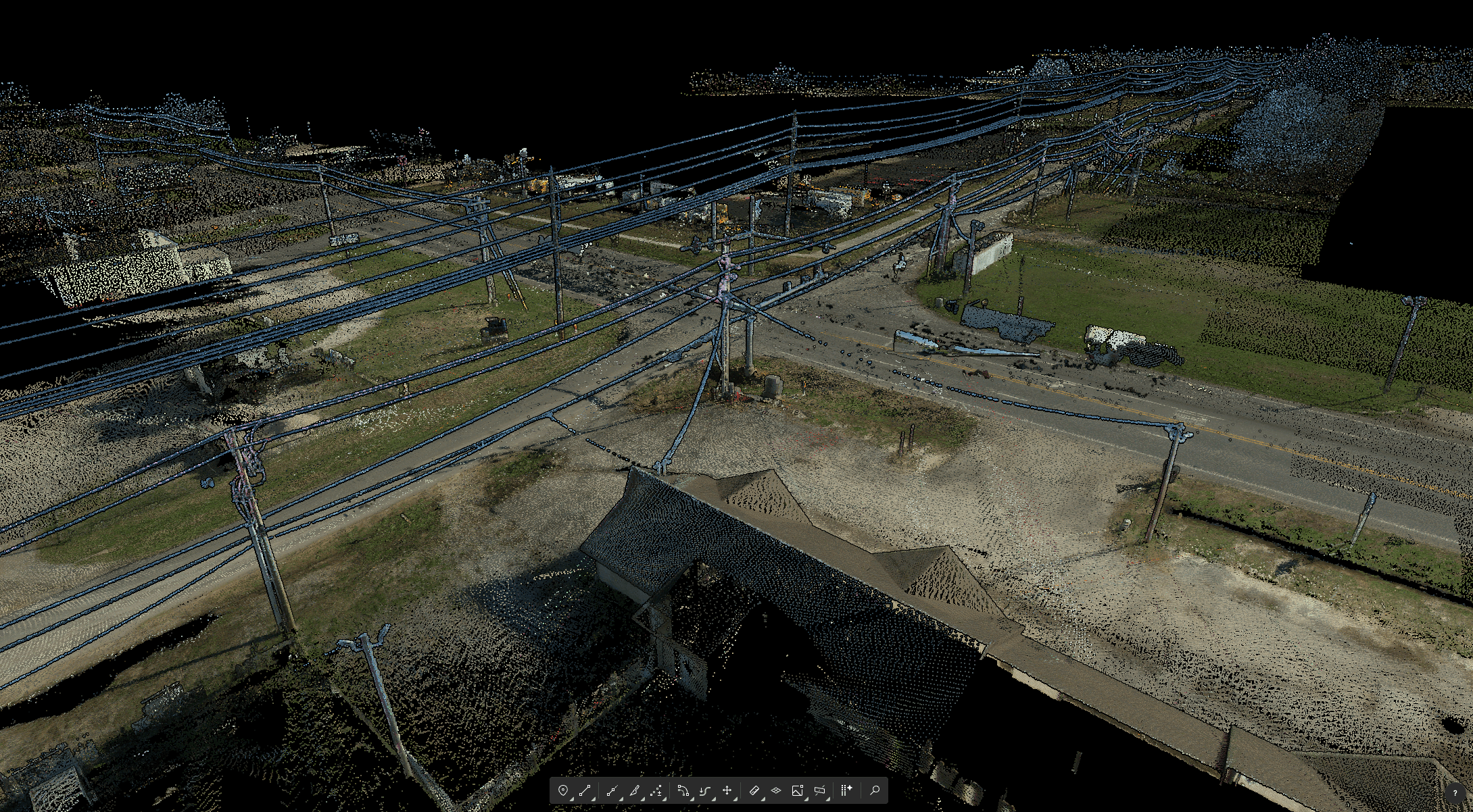
Turning Raw Point Cloud Data Into Reviewer-Ready Drafts with Mach9
Getting started with Mach9 was a quick and collaborative process. Built to work with CAD software like AutoCAD, Civil 3D, and MicroStation, Mach9 fit seamlessly into Olsson's production process. Meanwhile, the Mach9 team stayed close to ensure a smooth onboarding, answering emails and jumping on calls as questions arose. "From day one, we felt like Mach9 was a part of the team rather than a separate company," shares Eddie. "You could tell they were genuinely invested in our success."
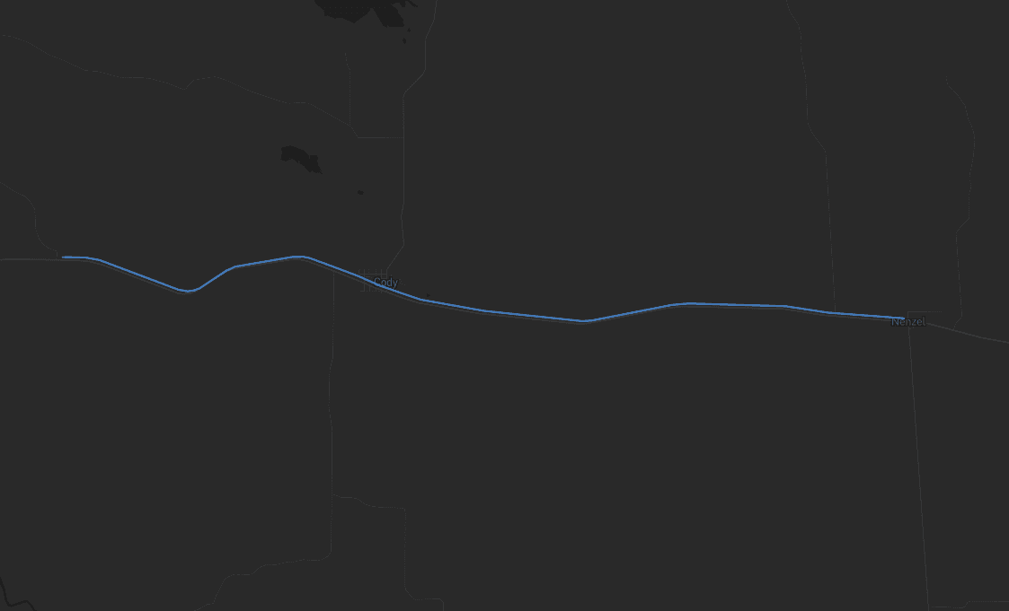
With this setup, Eddie's team deployed Mach9 on a DOT redesign project spanning a highway with an interstate overpass, a roundabout, and dense overhead power lines.
Once the dataset was uploaded, Mach9 parsed through the full complexity of the corridor, navigating occlusions and layered infrastructure to extract curb and gutter, utility poles, and concrete embankments. What came back was a first-pass draft of a 3-mile route, compressing days of manual extraction into a single 15-minute run.
This workflow became foundational to every Olsson project. Eddie's team now moves straight to verification, streamlining the production cycle while preserving time for the expert judgment that design-grade deliverables require. With extracted features fully editable, technicians validate and refine linework directly in the platform. And because Mach9 adapts to the team's drawing patterns in real time, the platform's suggestions across the dataset always reflect Olsson's quality standards.
Mach9 changed how our team works. The time we used to spend on manual feature extraction, we now spend on parts that require expert judgment, like resolving edge-case geometry.
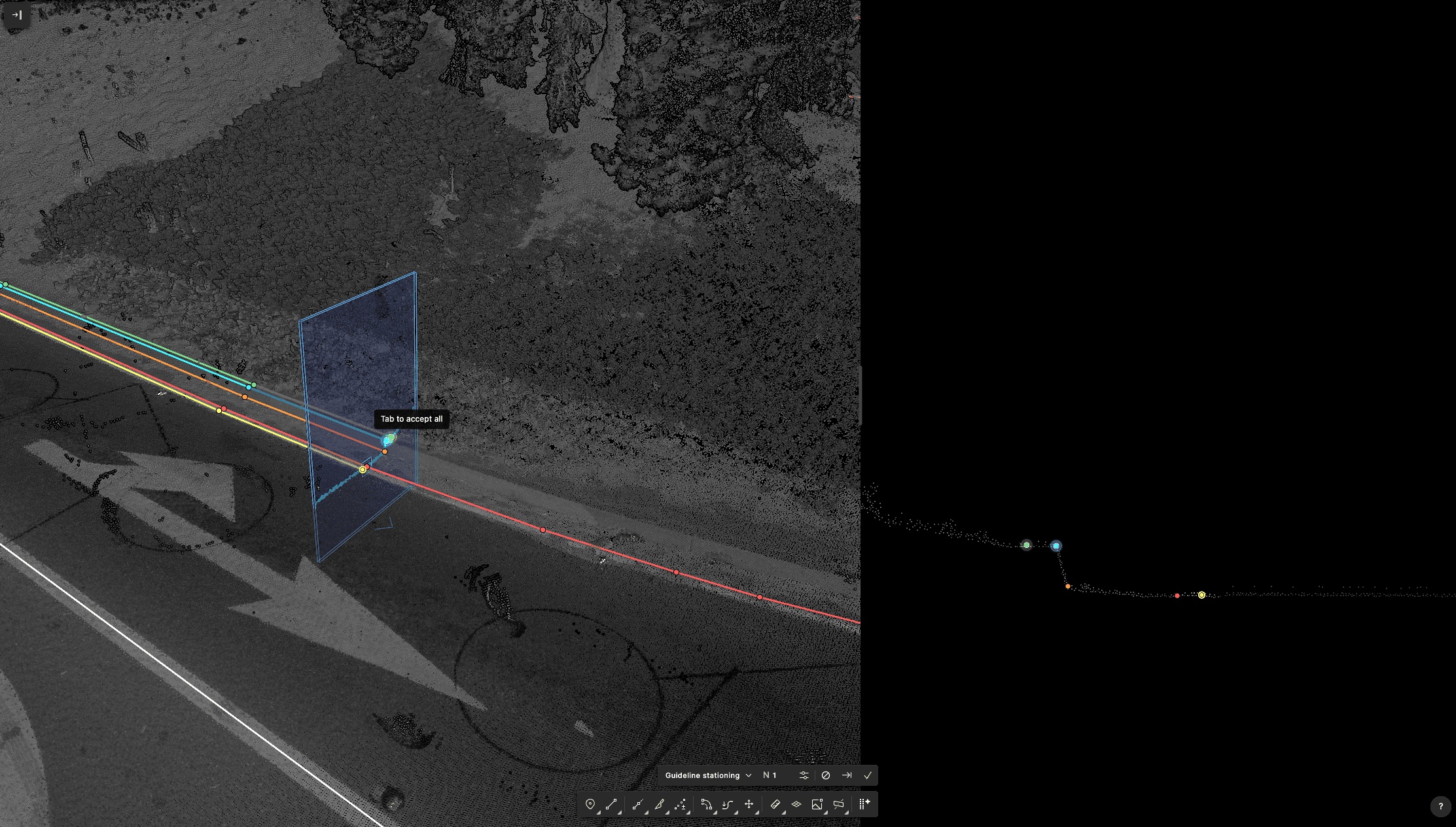
Today, Mach9 extracts 90% of features on the first pass, meaning additional field follow-ups are completed in days rather than weeks. In turn, crews reduce exposure to terrain hazards and free up time to survey more diverse sites, directly sharpening Olsson's competitive edge.
Once the dataset is complete, handing it off to designers is as simple as exporting the file to the relevant CAD platform. Designers receive linework that's ready to use without reformatting or reconciliation, while Eddie's technicians get to the next project faster.
Encouraged by these capacity gains, Eddie's team scaled Mach9 across complex pad site projects and DOT corridor work. Large, multi-year infrastructure programs now stay in-house, handled at the standard clients expect without the overhead.
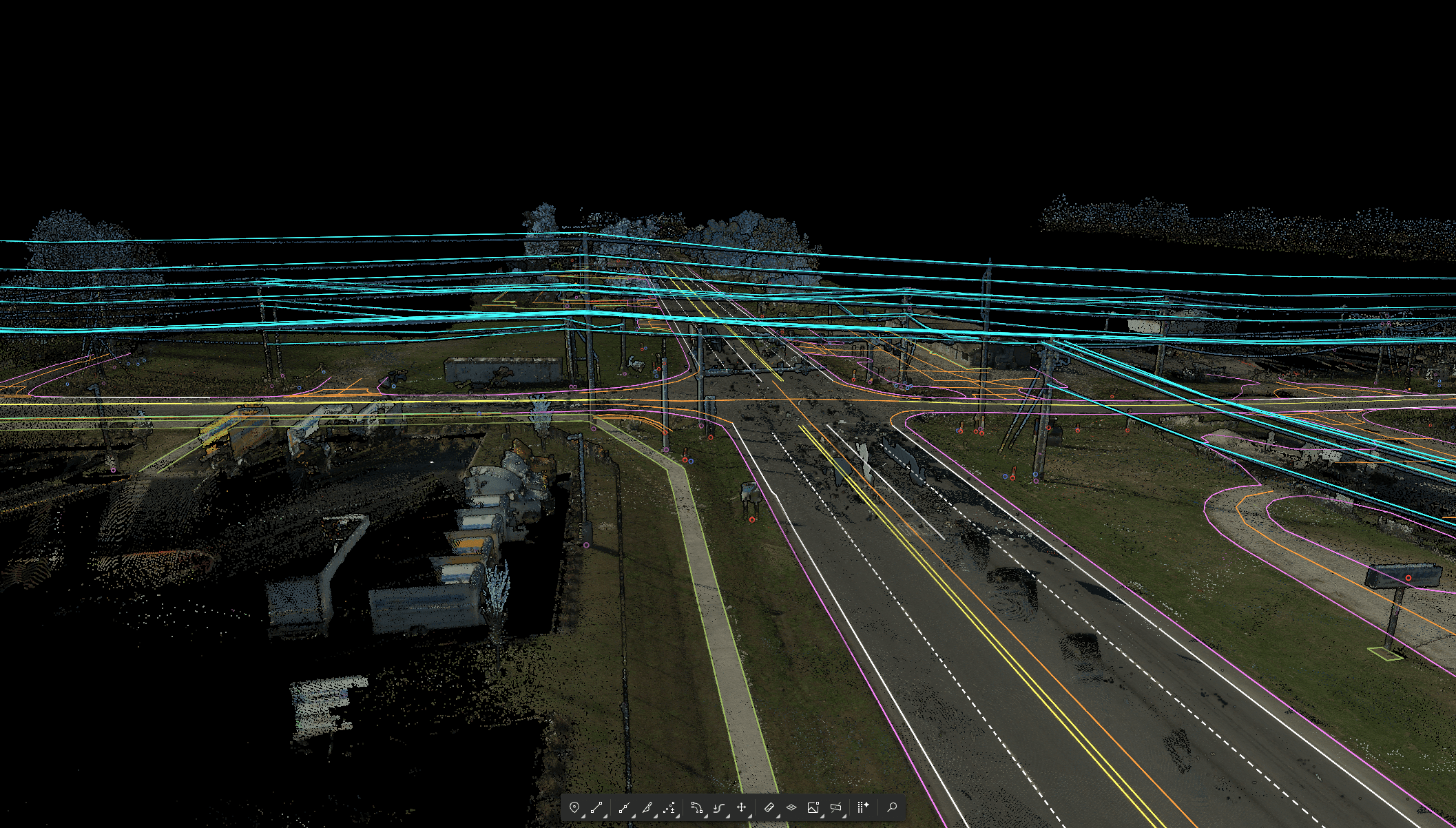
Olsson Scales In-House Project Capacity Without Sacrificing Accuracy, Quality, or Consistency
With Mach9, Olsson delivers complex, data-rich projects like the DOT highway corridor in a fraction of the time while maintaining the design-grade accuracy their clients depend on. Eddie's team now has the capacity to take on valuable infrastructure work in-house, significantly expanding the firm's project pipeline.
- 0160% faster survey-to-CAD workflows
- 023 miles of roadway features extracted for review in 15 minutes
- 0390% of features extracted on the first pass
- 04Significant reduction in live traffic exposure and field incidents
Looking ahead, the Olsson team plans to expand its use of Mach9 across a broader range of pad site projects. Eddie is especially excited to pair Mach9's automated feature extraction with the speed of aerial scanning.
Our partnership with Mach9 only gets more valuable with time. Their product is constantly evolving to support our drafting workflows. That type of continuous innovation is hard to come across.
Mach9 works with the data you already collect.






Olsson is a full-service engineering and design firm serving a broad range of clients across state and local governments and the private sector. They handle design-grade projects at scale, from linear corridor surveys to complex pad site assessments. Dedicated to precision, efficiency, and field safety in every engagement, Olsson has been recognized as a top 20 industrial and top 25 government engineering firm in America.

Mach9 accelerates how teams model and understand the world with automated feature extraction technology. Founded in 2021 and headquartered in San Francisco, Mach9 helps transportation agencies, utility companies, and engineering firms extract miles of road corridor projects in a fraction of traditional processing time. Built on decades of research from Carnegie Mellon University's Robotics Institute, Mach9 empowers the architecture, engineering, and construction industries to tackle large-scale infrastructure projects with unprecedented speed and accuracy.
More case studies
See all →
Turning Roadway Assets into Actionable Data for State DOT

Accelerating Rural Broadband Expansion Through Automation and Visibility

Data Collection First, Decisions Later: A Smarter Way to Design Broadband
Turn weeks of drafting into hours

Mach9 shaves weeks and weeks off extraction on our civil corridor projects. We can fly through vertices and line work in 3D — half our data is already done before we start verifying.”
A recurring theme in the civil engineering industry is how difficult it is to find trained technicians. Mach9 enables us to do 50% more work with the same experienced team. That's extremely important for us.”
Mach9 changed how our team works. The time we used to spend on manual feature extraction, we now spend on parts that require expert judgment, like resolving edge-case geometry.”
With Mach9, we now have a state-of-the-art feature extraction workflow. Instead of spending hours tracing objects in a point cloud, we directly review Mach9's AI-generated assets.”
One of the best things about Mach9 is that you get immediate value without any learning curve. The feature extraction is super accurate, and you go from point mapping to a design-grade deliverable seamlessly.”
The ability to perform full QA in a single interface, without jumping between systems, has transformed how we approach statewide inventories. Mach9 brought consistency and confidence to our data workflows.”
Director of Reality Capture, Feldman GeospatialRob Ashley
HDLS Technology Director, PennoniEddie Fossler
VP & Quality Management Leader, OlssonKaty Sprenger
GIS Specialist, TruenetDiana Wohlfarth
PennoniJeff Tornatore
Project Manager, Michael Baker International
Step 1 of 3