Pennoni increased civil infrastructure project capacity by 50% with Mach9.
Discover how this established engineering firm partnered with Mach9 to consolidate fragmented drafting tools, accelerate survey-to-CAD workflows, and capitalize on growing project demand.

A recurring theme in the civil engineering industry is how difficult it is to find trained technicians. Mach9 enables us to do 50% more work with the same experienced team. That's extremely important for us.

Tool Sprawl Created Coordination Bottlenecks and Capped Growth
Getting a single job done meant moving LiDAR data through several different tools. We needed one solution that could help us process point cloud data faster while streamlining our drafting workflow. Mach9 delivered on those asks from day one.
With over 40 offices located across the U.S., Pennoni supports a wide range of roadway, topographic, and scan-to-BIM projects. Rob Ashley, HDLS Technology Director, and Diana Wohlfarth, Assistant Project Manager, lead the LiDAR technician team that transforms field data into the CAD deliverables engineers need to move these projects forward.
However, as the firm continued to expand, Rob and Diana soon realized the team's tech stack would need to evolve to keep pace with incoming project volume. At the time, Pennoni's drafting workflow was fragmented across several tools, including Cyclone, 3DR, and TopoDOT. Depending on the project and required deliverable, the team assembled a different combination of software to extract specific features, build surfaces and breaklines, and prepare files for design.
Tight deadlines often pushed the team to work in parallel across the same dataset and tech stack. Rob and Diana split linework, surface creation, and breaklines among technicians, then exported and merged their outputs into one AutoCAD or MicroStation file.
Because these files inform engineering design and construction, Rob and Diana couldn't afford to compromise on accuracy. Any error or missed feature could trigger additional field verifications, scheduling delays, and construction rework, creating unnecessary costs and undermining client confidence.
Yet, maintaining that standard following this multi-step workflow became significantly time-consuming. Moving work between applications required Pennoni's technicians to verify that geometry translated correctly and units remained consistent. Coordination among technicians also increased the risk of communication gaps, inconsistencies, and costly rework. Rob and Diana needed a solution that would unify Pennoni's drafting workflow and increase throughput with design-grade quality.
That search ultimately led them to Mach9. Its feature-extraction solution immediately stood out as a clear path to accelerate the transition from point cloud to CAD deliverables while helping the team consolidate its drafting workflow under a single source of truth.
A Unified Platform That Produces Design-Grade Deliverables at Scale
Mach9 integrated directly with Pennoni's AutoCAD, Civil 3D, and MicroStation workflows, offering a single solution for producing design-grade deliverables. While Mach9 provided hands-on support at every step, the Pennoni team found the tool "extremely intuitive and self-explanatory," as Diana shares.
Rob and Diana started by launching a three-week pilot covering roadway and topographic survey data. After validating Mach9's AI-generated output against Pennoni's quality standards, they confidently expanded the tool across the team.
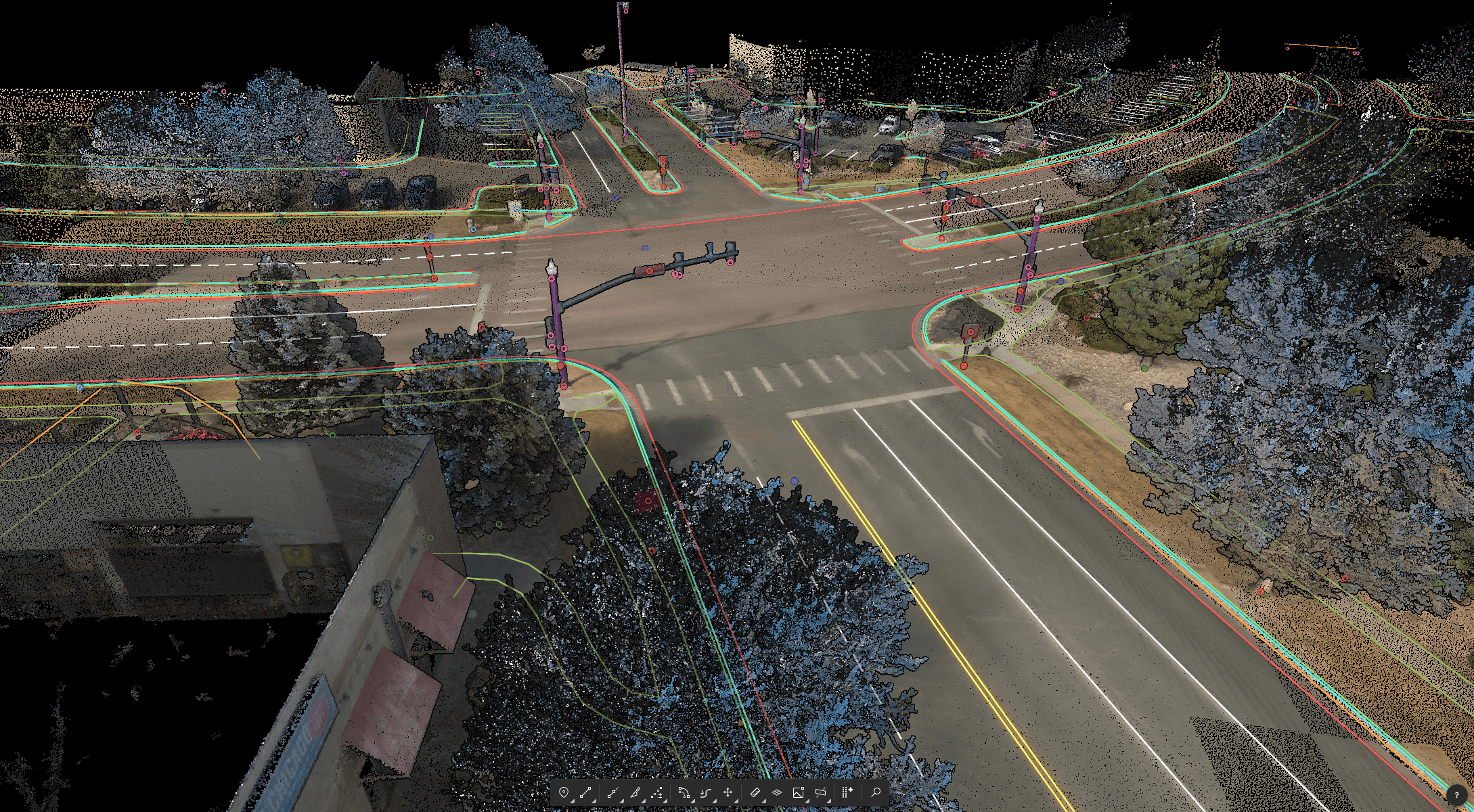
Today, Mach9 serves as the backbone of Pennoni's drafting process. The tool ingests E57 and LGSX LiDAR files from transportation surveys and other civil infrastructure projects, and generates a comprehensive first-pass draft in just an hour. Despite this accelerated turnaround, all features, from 2D and 3D lines to curbs, manholes, and utility poles, are extracted with design-grade accuracy. When Pennoni's team needs to perform manual QC, it's mostly limited to particularly tricky features, including aprons and curb ramps.
Because Mach9 is cloud-based, every technician works from the same live project using the latest version of the platform. The team no longer switches between specialized software to extract different feature types. Instead, their drafting workflows stay within a single platform, eliminating handoffs and reducing the coordination that previously slowed production.
With this setup, Pennoni's technicians begin every project by applying expert judgment through detailed QA and refinements. If changes are needed, they edit the geometry directly against the point cloud. Each correction refines the platform's extraction recommendations, reducing the need for manual updates across the rest of the dataset.
One of the best things about Mach9 is that you get immediate value without any learning curve. The feature extraction is super accurate, and you go from point mapping to a design-grade deliverable seamlessly.

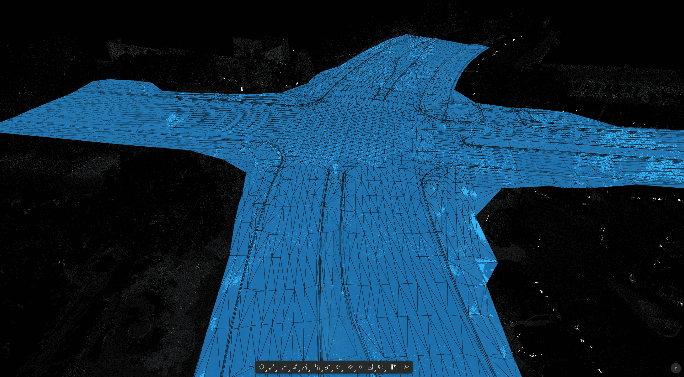
Beyond feature extraction, Pennoni uses Mach9 to generate terrain models representing bare-earth elevations for roadway design, drainage analysis, grading, and earthwork calculations. By producing those existing-ground surfaces directly from the LiDAR dataset, engineers receive existing conditions earlier, shortening the time to design.
This quick time-to-value has been matched by an equally responsive partnership. Rob and Diana meet regularly with Mach9 to share workflow feedback, discuss upcoming releases, and identify opportunities for further optimization. Seeing this level of dedication and the accompanying gains, Pennoni quickly expanded Mach9 to two additional offices, standardizing a faster, more scalable approach to LiDAR production.
Pennoni Increases Throughput and Capitalizes on Project Demand with Mach9
Partnering with Mach9 enabled Pennoni to replace a fragmented drafting process with a single, cloud-based workflow that generates design-grade deliverables in hours instead of days. By automating time-intensive extraction work and reducing manual handoffs, the team now completes roadway and topographic survey projects faster while maintaining headcount.
- 0150% increase in project capacity without adding headcount
- 0260% faster survey-to-CAD workflows
- 0390% faster ramp-up during training on survey-to-CAD workflows
Looking ahead, Rob and Diana are excited to see how Mach9's upcoming TIN Surface feature will enable the team to build existing-ground surfaces and export ready-to-use LandXML files even faster.
As Mach9 adds more features, we can bring more of our workflows into one platform and expand that capability across Pennoni. We're already seeing adoption grow beyond our initial rollout.
Mach9 works with the data you already collect.






Pennoni is a multidisciplinary engineering and consulting firm that partners with public- and private-sector clients to create resilient, sustainable infrastructure. The firm brings long-term partnership, innovation, and environmental stewardship to large-scale initiatives like complex transit network modernizations and urban stormwater retrofits. Pennoni is consistently recognized by the American Council of Engineering Companies (ACEC) for engineering excellence and has received multiple ACEC/PA Diamond Awards for its projects.

Mach9 accelerates how teams model and understand the world with automated feature extraction technology. Founded in 2021 and headquartered in San Francisco, Mach9 helps transportation agencies, utility companies, and engineering firms extract miles of road corridor projects in a fraction of traditional processing time. Built on decades of research from Carnegie Mellon University's Robotics Institute, Mach9 empowers the architecture, engineering, and construction industries to tackle large-scale infrastructure projects with unprecedented speed and accuracy.
More case studies
See all →
Turning Roadway Assets into Actionable Data for State DOT

Accelerating Rural Broadband Expansion Through Automation and Visibility

Data Collection First, Decisions Later: A Smarter Way to Design Broadband
Turn weeks of drafting into hours

Mach9 shaves weeks and weeks off extraction on our civil corridor projects. We can fly through vertices and line work in 3D — half our data is already done before we start verifying.”
A recurring theme in the civil engineering industry is how difficult it is to find trained technicians. Mach9 enables us to do 50% more work with the same experienced team. That's extremely important for us.”
Mach9 changed how our team works. The time we used to spend on manual feature extraction, we now spend on parts that require expert judgment, like resolving edge-case geometry.”
With Mach9, we now have a state-of-the-art feature extraction workflow. Instead of spending hours tracing objects in a point cloud, we directly review Mach9's AI-generated assets.”
One of the best things about Mach9 is that you get immediate value without any learning curve. The feature extraction is super accurate, and you go from point mapping to a design-grade deliverable seamlessly.”
The ability to perform full QA in a single interface, without jumping between systems, has transformed how we approach statewide inventories. Mach9 brought consistency and confidence to our data workflows.”
Director of Reality Capture, Feldman GeospatialRob Ashley
HDLS Technology Director, PennoniEddie Fossler
VP & Quality Management Leader, OlssonKaty Sprenger
GIS Specialist, TruenetDiana Wohlfarth
PennoniJeff Tornatore
Project Manager, Michael Baker International
Step 1 of 3