TrueNet accelerated complex telecom infrastructure route mapping with Mach9.
A 51-mile Ohio underground telecom project moved from weeks of manual tracing to engineering-grade deliverables in days.

We made a significant investment in LiDAR technology in anticipation of the industry's shift toward digital data collection. Mach9 enhances the value of that investment by transforming raw field data into engineering-ready deliverables.

Accelerating LiDAR Data Processing for a Dense Infrastructure Corridor
Suddenly, we were operating at the forefront of data collection technology, but still couldn't get deliverables into our engineers' hands as fast as we wanted. We needed a feature extraction solution, but most vendors approached our requirements purely from a sales perspective. Mach9 was the only one that demonstrated true industry expertise.
Like most established infrastructure engineering companies, TrueNet spent decades relying on field walkouts for geospatial data collection. Amid internal calls to modernize this process and scale project intake, Matt Woolley, Vice President of Information Technology, invested heavily in LiDAR vehicles that automatically capture millions of 3D data points per second. However, this innovation came with a new operational requirement: processing hundreds of gigabytes of dense, unstructured point data.
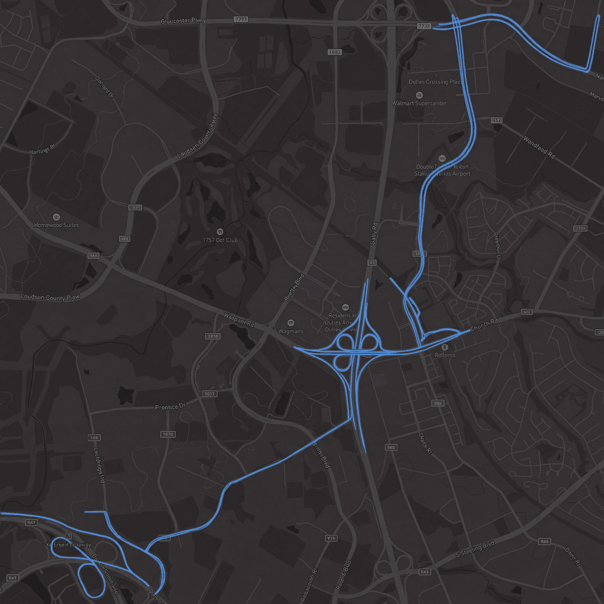
That demand came into sharp focus during a 51-mile underground telecom network project in Ohio, a state where dense infrastructure makes geospatial work especially demanding. To generate an engineering-ready CAD deliverable for the planned fiber route, TrueNet's team had to identify and extract every line, object, and surface from their mobile LiDAR and imagery data.
Yet, with overlapping tree cover and roadway features blurring together, this process required "weeks of manual tracing," as Ethan Keller, Digital Capture Project Supervisor, notes. This overhead not only diverted time and focus from other crucial priorities but also constrained TrueNet's project intake.
Speed was only half of the equation. Interpreting visually similar clusters of point cloud data was cognitively demanding by nature. While OSP drafters collaborated closely with in-house engineers, inaccurate calls remained a risk after hours spent navigating the dataset.
"If you're off by a few inches, you may instruct the construction crew to place critical infrastructure outside of the designated right-of-way," explains Katy Sprenger, GIS Specialist at TrueNet. Potential incidents would then lead to utility disruptions, stalled permit approvals, and rework requests, impacting both future project opportunities and community safety.
Matt knew there had to be a more efficient way to process Ohio's dense corridor datasets, so he set out to find a solution that could automatically deliver engineering-grade renderings at scale.
That's when he discovered Mach9. After a firsthand demo with the company's founder, Matt realized that their platform and deep industry expertise were exactly what TrueNet needed to complete the Ohio project on time and to spec.
Automated Feature Extraction with Engineering-Grade Accuracy
The partnership started with a hands-on onboarding. TrueNet shared their LiDAR data with the Mach9 team, who worked alongside them to establish a repeatable process from field capture to final deliverable. "The Mach9 team sat down and strategized with us at every step," Matt shares. "We felt like our success was their success."
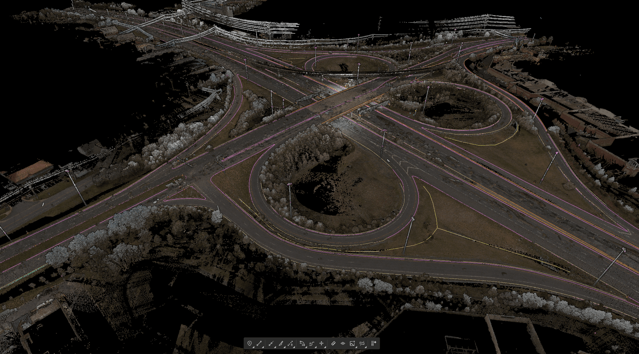
Once the TrueNet team had uploaded their LiDAR data, Mach9 extracted every line and object from Ohio's layered route in detail, from imperceptible curb edges and manholes to overhanging tree canopies.
With this automated draft, Katy and her team came into the project focused on refinement rather than labor-intensive manual tracing. Every extracted line and object was fully editable, so the team could validate and adjust on the fly. And because Mach9 enables feature filtering by type, Katy split reviews across OSP drafters to ensure every asset class received dedicated attention.
With Mach9, we now have a state-of-the-art feature extraction workflow. Instead of spending hours tracing objects in a point cloud, we directly review Mach9's AI-generated assets.

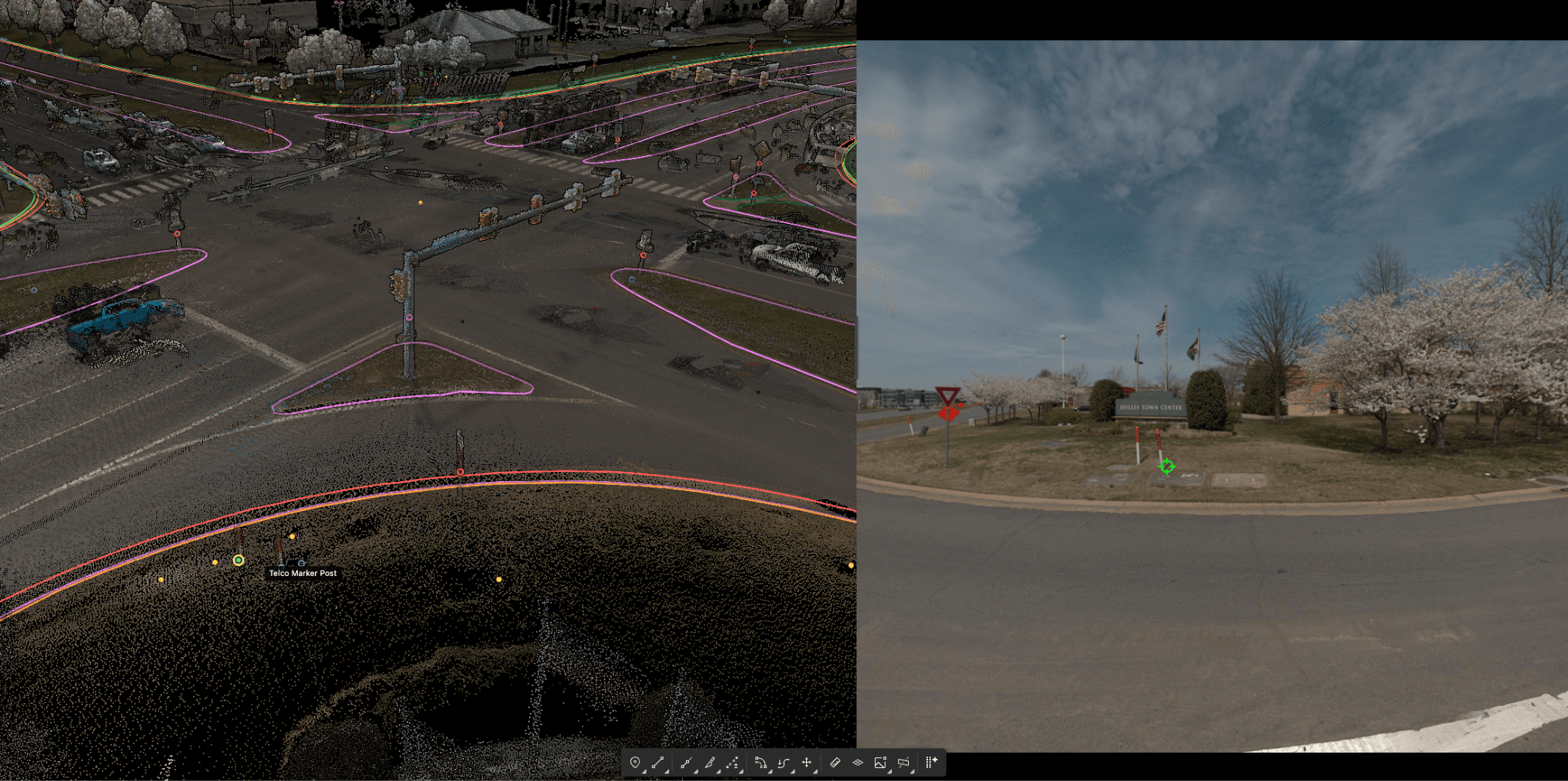
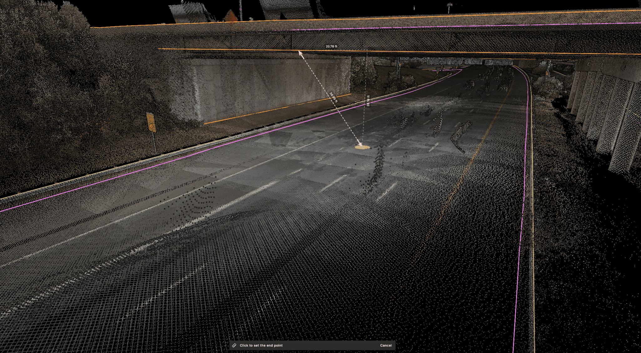
Mach9 supported the team across the QA process. To capture the exact vertical clearance at bridge underpasses and along pole lines, the team pulled Mach9's measurement tool. Using this data, they eliminated potential field conflicts and costly redesigns down the line.
As each OSP drafter moved through their section, Mach9 offered real-time suggestions. Accepted suggestions fed back into Mach9's understanding of the corridor, refining its predictions across the remaining areas of each OSP drafter's assigned route. As a result, the team cleaned curb returns, poles, and utility linework with far less back-and-forth.
This combination of precision tooling and team-led reviews delivered engineering-grade accuracy across the full route. "We had everything we needed to export to CAD with confidence," shares Ethan. "We didn't worry about the chance of imprecise drills because the details were pinned down."
That project established Mach9 as a productivity multiplier for TrueNet's team. By handling repetitive extraction work, the platform accelerates project delivery and positions TrueNet to pursue project volumes previously out of reach.
TrueNet Delivers the Ohio Project Significantly Faster While Enhancing Overall 3D Mapping Precision
With Mach9, TrueNet expedited the completion of its Ohio project while solidifying data extraction infrastructure that scales alongside project velocity. With their reclaimed bandwidth, TrueNet's team now focuses on QA decisions that require expert judgment while supporting more concurrent projects.
- 01Significantly faster project delivery
- 02Substantially improved 3D mapping accuracy
- 03Large-scale route coverage in record time
Looking ahead, the TrueNet team is eager to continue using Mach9 to keep pace with a project pipeline spanning thousands of miles. Ethan and Katy are especially excited to see how Mach9's upcoming pole attachment feature will enable them to trace more complete utility features on the first pass.
Mach9 consistently delivers new features with exceptional speed. Needs identified during discussions are often reflected in product updates shortly thereafter. This responsiveness and dedication position them as a highly valuable long-term partner.

Mach9 works with the data you already collect.






TrueNet Communications is an industry-leading OSP engineering and professional services company that provides advanced outside plant solutions to the telecommunications and critical infrastructure markets. Founded in 1985, TrueNet combines over 40 years of experience in design, construction, implementation, and support with the latest innovative, exclusive automation tools across the United States and Canada.
In 2016, TrueNet became a subsidiary of Fujitsu Network Communications, one of the world's largest IT services companies, adding world-class expertise and resources as a total solution provider.

Mach9 accelerates how teams model and understand the world with automated feature extraction technology. Founded in 2021 and headquartered in San Francisco, Mach9 helps transportation agencies, utility companies, and engineering firms extract miles of road corridor projects in a fraction of traditional processing time. Built on decades of research from Carnegie Mellon University's Robotics Institute, Mach9 empowers the architecture, engineering, and construction industries to tackle large-scale infrastructure projects with unprecedented speed and accuracy.
More case studies
See all →
Turning Roadway Assets into Actionable Data for State DOT

Accelerating Rural Broadband Expansion Through Automation and Visibility

Data Collection First, Decisions Later: A Smarter Way to Design Broadband
Turn weeks of drafting into hours

Mach9 shaves weeks and weeks off extraction on our civil corridor projects. We can fly through vertices and line work in 3D — half our data is already done before we start verifying.”
A recurring theme in the civil engineering industry is how difficult it is to find trained technicians. Mach9 enables us to do 50% more work with the same experienced team. That's extremely important for us.”
Mach9 changed how our team works. The time we used to spend on manual feature extraction, we now spend on parts that require expert judgment, like resolving edge-case geometry.”
With Mach9, we now have a state-of-the-art feature extraction workflow. Instead of spending hours tracing objects in a point cloud, we directly review Mach9's AI-generated assets.”
One of the best things about Mach9 is that you get immediate value without any learning curve. The feature extraction is super accurate, and you go from point mapping to a design-grade deliverable seamlessly.”
The ability to perform full QA in a single interface, without jumping between systems, has transformed how we approach statewide inventories. Mach9 brought consistency and confidence to our data workflows.”
Director of Reality Capture, Feldman GeospatialRob Ashley
HDLS Technology Director, PennoniEddie Fossler
VP & Quality Management Leader, OlssonKaty Sprenger
GIS Specialist, TruenetDiana Wohlfarth
PennoniJeff Tornatore
Project Manager, Michael Baker International
Step 1 of 3